CRF Strategy
Data-driven road condition assessments for road maintenance and asset management
Data-driven road condition assessments for road maintenance and asset management
CRF Strategy brings two decades of experience in the transportation industry. We are available to assist an agency of any size to find the best and most cost-effective solutions for your budget. Whether it is data collection, data processing, pavement analysis, asset management or anything related to your infrastructure needs, CRF Strategy is a trusted partner.

CRF Strategy + RoadMetrics
CRF Strategy has partnered with RoadMetrics AI to introduce their leading technology and software in the United States. Using the RoadMetrics smartphone app and AI tools, CRF Strategy provides high quality image, pavement and sign data quickly to our customers at a price that will fit any budget.
With the RoadMetrics platform, road assessments and asset tracking are automated and objective, improving the efficiency of your road maintenance efforts.
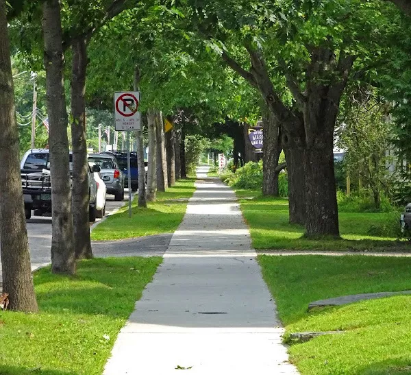
Streets · Sidewalks · Bike Paths
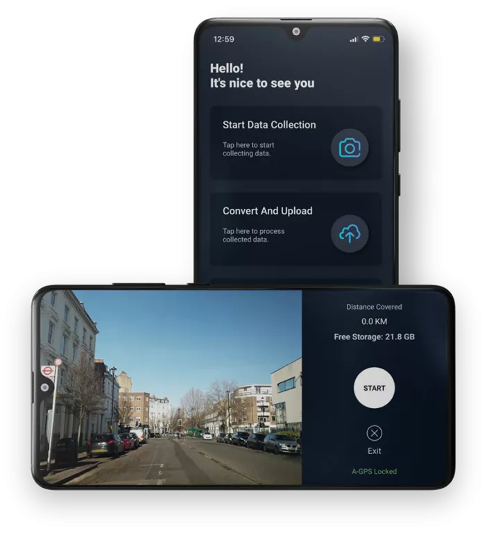
Data collection has been made more efficient and less expensive without trading quality or accuracy. Using a smartphone mounted on the inside windshield, CRF Strategy can provide data collection on your entire road and street network and depending on the size, can be completed in days or weeks. Using the custom RoadMetrics Data Collection application and location information from the phone, imagery is collected at posted speeds. A full pavement assessment and sign inventory can be completed quickly and within the constraints of your budget.
Also, since no large equipment or sensors are required, data on Sidewalks and Ramps as well as Bike Paths can easily be collected within days. The RoadMetrics solution provides imagery and analysis on all your paved infrastructure.


Streets
Data visualized the RoadMetrics app
Advancements in technology have made it possible to get tangible results from data surveys within days. No more waiting months for your data to make maintenance and repair decisions that affect your budget. Manual inspections are tedious. With the RoadMetrics platform, road assessments and asset tracking are automated and objective, improving the efficiency of your road maintenance efforts. Data collection is uploaded daily and processed and is usable typically within 2 to 3 business days. After the start of a project, you will start receiving imagery and processed data almost immediately. CRF Strategy offers the data and software at a lower cost while providing you with the tools to effectively budget for maintenance and repair and provide an updated sign inventory at the same time.
The RoadMetrics web based GIS Enterprise Platform allows the user to use data to make decisions that impact your budget and planning.
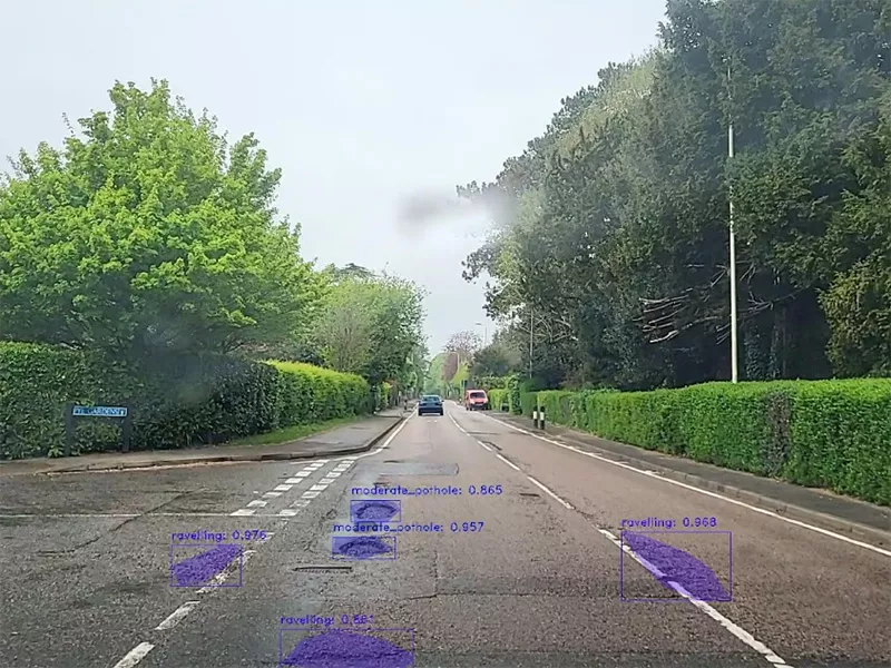
Once the video is uploaded on to our cloud servers, we extract an image point every 10 feet and use computer vision based machine-learning techniques to identify road carriageway defects. Based on the severity of the defects, roads are graded from level 0 to level 4 on our web-based GIS RoadMetrics Enterprise platform.
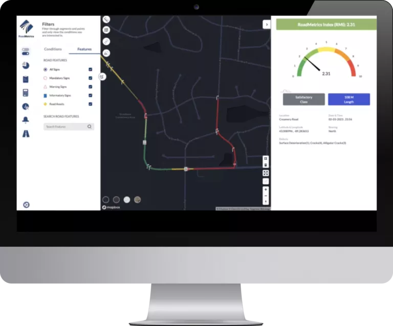
RoadMetrics software on a desktop computer
phone